The Glaciers of Norway
Even when hundreds of meters deep, glacier ice is always on the move and strong enough to shape the Earth. It was the Ice Age glaciers that carved out Norway’s characteristic fjords, valleys, and steep mountainsides. Remnants of those prehistoric glaciers remain in place today.

Some glaciers, like Tystigbreen and Folgefonna, are home to summer ski resorts with prepared slopes you can ski and snowboard in your t-shirt and work up a tan. The meltwater produces lush valleys below, bathing its rivers and fjords in a distinct greenish glow.
In Norway, as in the rest of the world, temperatures are rising due to climate change, and the glaciers are slowly melting. According to the Center for International Climate Research (CICERO), the total area covered by glaciers has decreased by 11 per cent in the last 30 years. Since the mid-1980s, more than 326 square kilometers of glaciers have disappeared. The northern parts of the country especially, is seeing them retreat at a rapid pace.
The monitoring of glaciers contributes important information to climate research. Researchers working from the ice shields of Greenland and Antarctica obtain ice cores that stretch several kilometers long and contain climate data going 800 000 years back in time.
Scientists agree that the amount of greenhouse gases in the atmosphere has increased, and that this will lead to climate change. But there are still uncertainties, given that man-made greenhouse effects and those occurring naturally affect each other. Moreover, we do not fully understand the driving forces behind the climate, e.g. the coupling between the sea, the atmosphere and feedback mechanisms, such as those influenced by changes in the Earth's surface, e.g. ice/snow covered landscapes turning to water.
Most climate researchers share the opinion that, by 2050, the Earth's climate may reach temperature conditions unlike anything mankind has experienced throughout history. We don’t know what life will be like on our planet then. Regulations or adjustments may become challenging for us and any counter-measures against climatic changes must be built on knowledge, not on fear.
The climatic challenges we face will need action at several levels. The issues have to be solved through national and international leadership. The actions of each individual are important - with a little effort, we can all make a big difference.
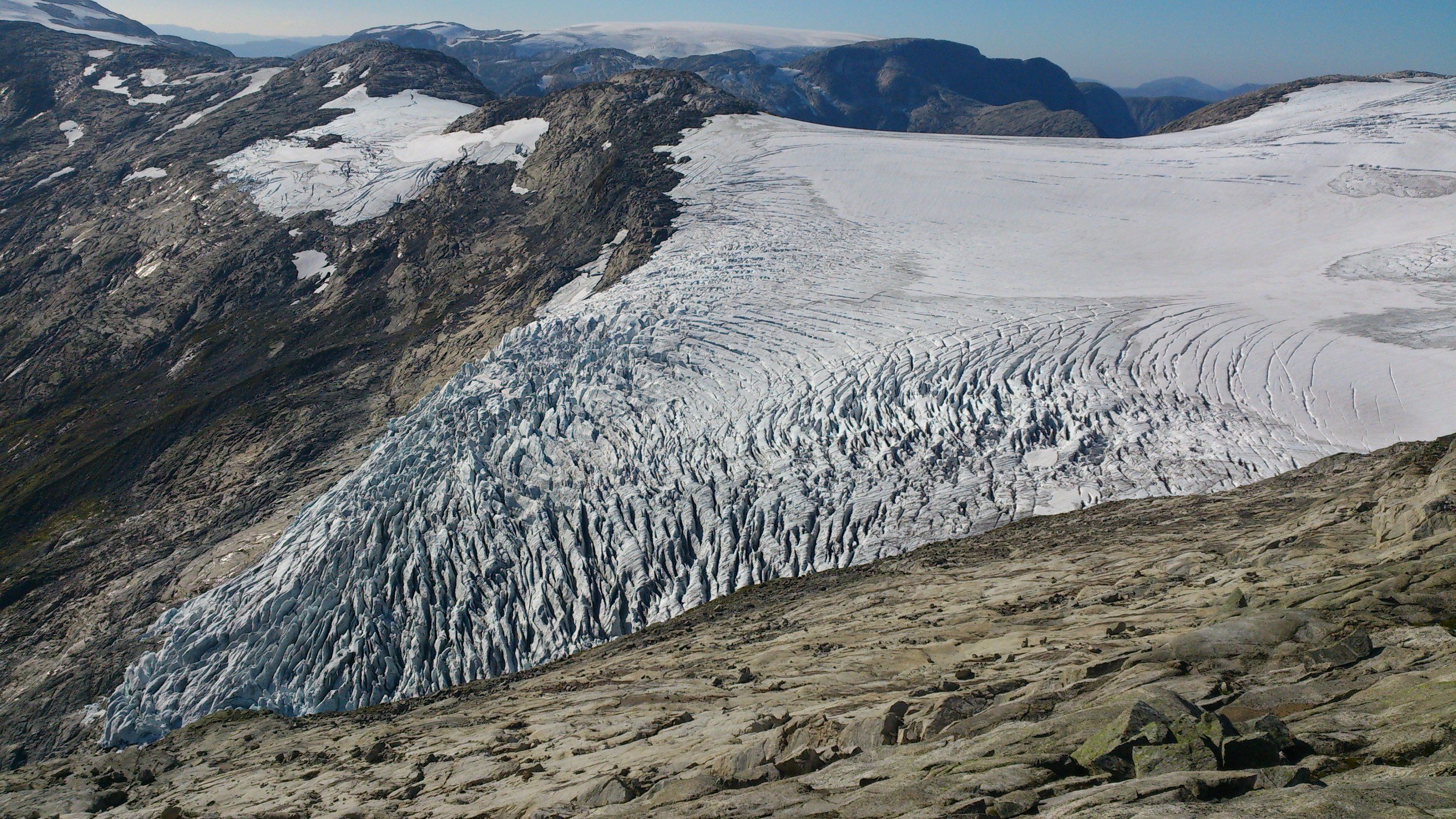
DID YOU KNOW THAT JOSTEDALSBREEN IS THE LARGEST GLACIER ON THE EUROPEAN CONTINENT?
It has a length of approx. 80 km (50 miles) and covers an area of 474 km2 (183 square miles). In several places the ice layer is over 500 m (546 yards) thick. The total ice mass stores as much fresh water as you can fill into 300.000.000.000 bathtubs – enough to supply Norway with water for over 100 years. Read more facts on the National Park page.

Bøyabreen Glacier 2014. Photo: Pål Gran Kielland.
DID YOU KNOW THAT THERE ARE 2534 GLACIERS IN NORWAY?
There are 1252 in the southern part of Norway, covering a total area of 1523 km2. In the northern part of Norway there are 1282 glaciers covering 1169 km2. In addition, Spitsbergen has 2128 glaciers, and they cover an area of 36591 km2 in total.
Vetle Bøyabreen Glacier 2014. Photo: Pål Gran Kielland.
DID YOU KNOW THAT JOSTEDALSBREEN IS NOT A REMNANT OF THE LAST ICE AGE?
About 8000 years ago, during a period of warmer climate called Atlanticum, the glacier most probably disappeared. When the climate cooled again some 5000 years ago, a new glacier formed.

Supphellebreen Glacier 2010. Foto: Torunn Bøe.
Jostedalsbreen National Park is a landscape shaped by ice and water. The National Park was established by Royal Decree on 25 October 1991. It covers 1315 sq. km, with half of the area covered by glacier, and 90 % above 800 m elevation. The Jostedalsbreen is the largest glacier on the European Continent with an area of 474 km² (183 sq. miles).
The purposes behind establishing the National Park were:
to protect a large, varied glacier area with associated fauna, flora and geology
to permit enjoyment of nature not dependent upon technical facilities
to protect our cultural heritage
A FEW FACTS ABOUT THE JOSTEDALSBREEN ICE CAP
Area: 474 km² (183 sq. miles)
Length: 60 km (37 miles)
Highest elevation: 1957 m asl. (Høgste Breakulen)
Lowest elevation: 60 m asl. (the foot of the glacier Supphellebreen)
Maximum thickness: 571 m
Greatest snow depth measured: 12 m
Total erosion of rock material: 400 000 tons/year
Glacier volume: 73 km³ (95 • 10 cu.yd)
Fresh water equivalent: 73 • 10¹² litres (16 • 10¹² gal.) = 300 thousand millions bathtubs of water or the water consumption in Norway for 100 years